
La Machotte topographic map
Interactive map
Click on the map to display elevation.
About this map
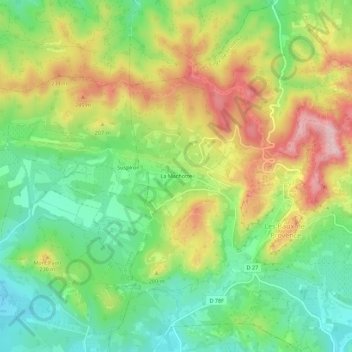
Name: La Machotte topographic map, elevation, terrain.
Average elevation: 148 m
Minimum elevation: 50 m
Maximum elevation: 283 m
Other topographic maps
Click on a map to view its topography, its elevation and its terrain.
Table d'orientation des Baux
France > Provence-Alpes-Côte d'Azur > Bouches-du-Rhône > Les Baux-de-Provence
Table d'orientation des Baux, DFCI-AL-110, Les Baux-de-Provence, Arles, Bouches-du-Rhône, Provence-Alpes-Côte d'Azur, France métropolitaine, 13520, France
Average elevation: 187 m