
Thank you for supporting this site ❤️
Make a donation
Make a donation
Gear up for your next adventure:
As an Amazon Associate, this site earns from qualifying purchases at no extra cost to you.
Nowa Ruda topographic map
Click on the map to display elevation.
Thank you for supporting this site ❤️
Make a donation
Make a donation
Gear up for your next adventure:
As an Amazon Associate, this site earns from qualifying purchases at no extra cost to you.
About this map
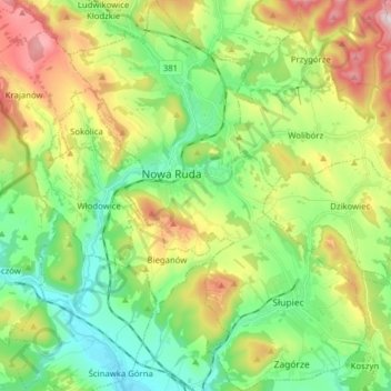
Name: Nowa Ruda topographic map, elevation, terrain.
Location: Nowa Ruda, Kłodzko County, Lower Silesian Voivodeship, Poland (50.52380 16.46021 50.62320 16.57949)
Average elevation: 486 m
Minimum elevation: 323 m
Maximum elevation: 787 m
Thank you for supporting this site ❤️
Make a donation
Make a donation
Gear up for your next adventure:
As an Amazon Associate, this site earns from qualifying purchases at no extra cost to you.