
Kampung Bukit Tambun topographic map
Interactive map
Click on the map to display elevation.
About this map
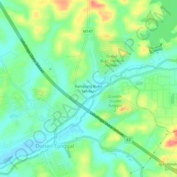
Name: Kampung Bukit Tambun topographic map, elevation, terrain.
Location: Kampung Bukit Tambun, Alor Gajah, Malacca, 76100, Malaysia (2.30470 102.26980 2.34470 102.30980)
Average elevation: 29 m
Minimum elevation: 3 m
Maximum elevation: 79 m