
Thank you for supporting this site ❤️
Make a donation
Make a donation
Gear up for your next adventure:
As an Amazon Associate, this site earns from qualifying purchases at no extra cost to you.
Reuth topographic map
Click on the map to display elevation.
Thank you for supporting this site ❤️
Make a donation
Make a donation
Gear up for your next adventure:
As an Amazon Associate, this site earns from qualifying purchases at no extra cost to you.
About this map
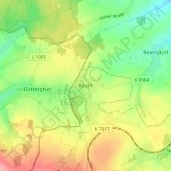
Name: Reuth topographic map, elevation, terrain.
Location: Reuth, Neumark, Vogtlandkreis, Sachsen, 08496, Deutschland (50.65272 12.29997 50.69272 12.33997)
Average elevation: 375 m
Minimum elevation: 317 m
Maximum elevation: 448 m
Thank you for supporting this site ❤️
Make a donation
Make a donation
Gear up for your next adventure:
As an Amazon Associate, this site earns from qualifying purchases at no extra cost to you.