
Make a donation
Gear up for your next adventure:
As an Amazon Associate, this site earns from qualifying purchases at no extra cost to you.
Seibranz topographic map
Click on the map to display elevation.
Make a donation
Gear up for your next adventure:
As an Amazon Associate, this site earns from qualifying purchases at no extra cost to you.
About this map
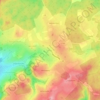
Name: Seibranz topographic map, elevation, terrain.
Average elevation: 737 m
Minimum elevation: 660 m
Maximum elevation: 789 m
Make a donation
Gear up for your next adventure:
As an Amazon Associate, this site earns from qualifying purchases at no extra cost to you.
Other topographic maps
Click on a map to view its topography, its elevation and its terrain.
Unterschwarzach
Deutschland > Baden-Württemberg > Landkreis Ravensburg > Bad Wurzach
Average elevation: 669 m
Seibranz
Deutschland > Baden-Württemberg > Landkreis Ravensburg > Bad Wurzach
Average elevation: 729 m
Rohrsee
Deutschland > Baden-Württemberg > Landkreis Ravensburg > Bad Wurzach > Eintürnen
Das rund 110 Hektar große Naturschutzgebiet „Rohrsee“ gehört zum Westallgäuer Hügelland. Es liegt auf einer durchschnittlichen Höhe von 667 m ü. NN, rund sechs Kilometer südwestlich der Stadtmitte Bad Wurzachs, zwischen den Ortsteilen Rohrbach im Osten und Rohr im Süden sowie dem zu Wolfegg…
Average elevation: 673 m
Make a donation
Gear up for your next adventure:
As an Amazon Associate, this site earns from qualifying purchases at no extra cost to you.