Geolocate

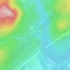
Les Rivières topographic map

Click on the map to display elevation.

About this map

Name: Les Rivières topographic map, elevation, terrain.

Location: Les Rivières, Quebec, Urban agglomeration of Québec, Capitale-Nationale, Quebec, Canada (46.78926 -71.36401 46.87015 -71.23917)

Average elevation: 53 m

Minimum elevation: 0 m

Maximum elevation: 171 m

Other topographic maps

Click on a map to view its topography, its elevation and its terrain.
Gear up for your next adventure:

🧴Sport Sunscreen Sticks - High-protection sunblock that won't run into your eyes on the trail
🔋Solar Chargers - Eco-friendly charging solutions for outdoor use
🍱Food Containers - Reusable containers for outdoor meals
📱Rugged Phone Cases - Heavy-duty protection for smartphones used as secondary GPS tools
☕Insulated Travel Mugs - Keep drinks hot while surveying the landscape from a summit

As an Amazon Associate, this site earns from qualifying purchases at no extra cost to you.