
Ungilde topographic map
Interactive map
Click on the map to display elevation.
About this map
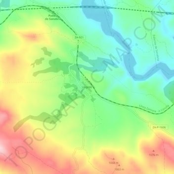
Name: Ungilde topographic map, elevation, terrain.
Location: Ungilde, Puebla de Sanabria, Zamora, Castilla y León, España (42.00833 -6.63645 42.04833 -6.59645)
Average elevation: 978 m
Minimum elevation: 877 m
Maximum elevation: 1,124 m