

Mahad topographic map
Click on the map to display elevation.
Mahad
Several disasters like floods and landslides have continuously devastated markets and old houses, specifically classic raw houses, causing great loss of life. This is primarily due to lower elevation of the city compared to surrounding areas and being surrounded by rivers on all sides, making the city like a triangular island. Also, Konkan, receives predominantly very heavy rainfall in comparison to rest of Maharashtra.
About this map
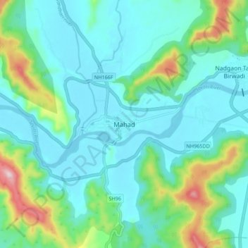
Name: Mahad topographic map, elevation, terrain.
Location: Mahad, Mahad Taluka, Raigad, Maharashtra, 402300, India (18.04075 73.38438 18.12075 73.46438)
Average elevation: 75 m
Minimum elevation: 0 m
Maximum elevation: 366 m
Other topographic maps
Click on a map to view its topography, its elevation and its terrain.
Raigad Fort
India > Maharashtra > Mahad Taluka > Vagheri > Chatri Nizampur
Located at an elevation of 820 metres (2,700 ft)above sea level in the Sahyadri mountain range, the fort offers panoramic views of the surrounding region. The fort was home to around 1,550 residents, with an average family size of five. Access to the fort requires ascending approximately 1,737 steps.…
Average elevation: 448 m