
Kersbeek-Miskom topographic map
Interactive map
Click on the map to display elevation.
About this map
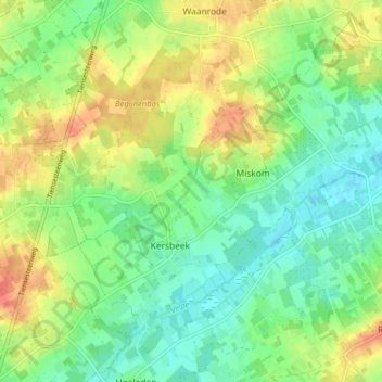
Name: Kersbeek-Miskom topographic map, elevation, terrain.
Average elevation: 48 m
Minimum elevation: 26 m
Maximum elevation: 81 m
Other topographic maps
Click on a map to view its topography, its elevation and its terrain.
Kattebeek
België > Vlaams-Brabant > Leuven > Kortenaken
Kattebeek, Kersbeek-Miskom, Kortenaken, Leuven, Vlaams-Brabant, Vlaanderen, 3472, België
Average elevation: 51 m