
Capellen topographic map
Interactive map
Click on the map to display elevation.
About this map
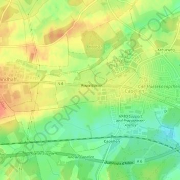
Name: Capellen topographic map, elevation, terrain.
Location: Capellen, Mamer, Canton Capellen, Luxembourg (49.64221 5.95874 49.64865 5.99692)
Average elevation: 317 m
Minimum elevation: 292 m
Maximum elevation: 340 m
Other topographic maps
Click on a map to view its topography, its elevation and its terrain.
Capellen
Luxembourg > Canton Capellen > Mamer
Capellen, Mamer, Canton Capellen, Luxembourg
Average elevation: 316 m