
Municipio Cotagaita topographic map
Interactive map
Click on the map to display elevation.
About this map
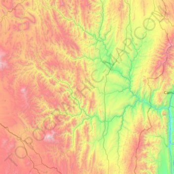
Name: Municipio Cotagaita topographic map, elevation, terrain.
Location: Municipio Cotagaita, Provincia Nor Chichas, PSI, Bolivien (-21.14972 -66.28738 -20.06548 -65.34947)
Average elevation: 3,507 m
Minimum elevation: 2,272 m
Maximum elevation: 5,429 m