Geolocate

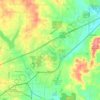
Paron topographic map

Click on the map to display elevation.

About this map

Name: Paron topographic map, elevation, terrain.

Location: Paron, Saline County, Arkansas, 72122, United States (34.75287 -92.77850 34.79287 -92.73850)

Average elevation: 171 m

Minimum elevation: 133 m

Maximum elevation: 273 m

Other topographic maps

Click on a map to view its topography, its elevation and its terrain.
Benton

United States > Arkansas > Saline County

Average elevation: 121 m

Bauxite

United States > Arkansas > Saline County

Average elevation: 120 m

East End

United States > Arkansas > Saline County

Average elevation: 95 m

Bryant

United States > Arkansas > Saline County

Average elevation: 125 m

Benton

United States > Arkansas > Saline County

Average elevation: 121 m

Bryant

United States > Arkansas > Saline County

Average elevation: 125 m

Bauxite

United States > Arkansas > Saline County > Bauxite

Average elevation: 120 m

Gear up for your next adventure:

🎒Multi-day Trekking Packs - Large capacity backpacks for wild camping and long-distance trails
🧭Professional Hiking Compasses - High-precision liquid-filled compasses for map reading and orientation
👕Technical Hiking Tees - Moisture-management for high-exertion climbs
🥾Walking Shoes - Lightweight walking shoes for countryside and coastal paths
❄️Walking Crampons - Added traction for icy slopes and winter peak bagging

As an Amazon Associate, this site earns from qualifying purchases at no extra cost to you.