Geolocate

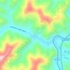
Pinsonfork topographic map

Click on the map to display elevation.

About this map

Name: Pinsonfork topographic map, elevation, terrain.

Location: Pinsonfork, Pike County, Kentucky, 41555, United States (37.53316 -82.28375 37.57316 -82.24375)

Average elevation: 396 m

Minimum elevation: 245 m

Maximum elevation: 606 m

Other topographic maps

Click on a map to view its topography, its elevation and its terrain.

Pikeville

United States > Kentucky > Pike County

Average elevation: 338 m

Elkhorn City

United States > Kentucky > Pike County

Average elevation: 364 m

Crow Hollow

United States > Kentucky > Pike County > Douglas

Average elevation: 348 m

Gear up for your next adventure:

🍲Portable Camping Stoves - Fast-boiling stoves for hot meals on remote topographic survey trips
📷Camera Straps - Secure straps for carrying cameras while walking
📐Altimeters & Barometers - Tools for measuring altitude and air pressure
🔥Emergency Fire Starters - Reliable ignition tools for survival situations in damp conditions
🧼Biodegradable Soap - Leave-no-trace hygiene for multi-day mountain treks

As an Amazon Associate, this site earns from qualifying purchases at no extra cost to you.