
Kloostereind topographic map
Interactive map
Click on the map to display elevation.
About this map
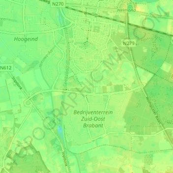
Name: Kloostereind topographic map, elevation, terrain.
Average elevation: 21 m
Minimum elevation: 10 m
Maximum elevation: 30 m
Other topographic maps
Click on a map to view its topography, its elevation and its terrain.
Helmond
Pays-Bas > Brabant-Septentrional > Helmond
Helmond, Brabant-Septentrional, Pays-Bas
Average elevation: 20 m