
Langda topographic map
Click on the map to display elevation.
About this map
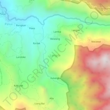
Name: Langda topographic map, elevation, terrain.
Location: Langda, Enrekang, South Sulawesi, Sulawesi, Indonesia (-3.46903 119.89196 -3.42903 119.93196)
Average elevation: 1,024 m
Minimum elevation: 566 m
Maximum elevation: 1,742 m
Other topographic maps
Click on a map to view its topography, its elevation and its terrain.