
Thank you for supporting this site ❤️
Make a donation
Make a donation
Gear up for your next adventure:
As an Amazon Associate, this site earns from qualifying purchases at no extra cost to you.
Kaman topographic map
Click on the map to display elevation.
Thank you for supporting this site ❤️
Make a donation
Make a donation
Gear up for your next adventure:
As an Amazon Associate, this site earns from qualifying purchases at no extra cost to you.
About this map
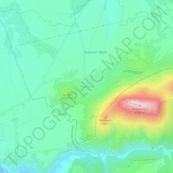
Name: Kaman topographic map, elevation, terrain.
Location: Kaman, Pınarbaşı, Kayseri, Centraal-Anatolië, Turkije (38.49205 36.13942 38.53205 36.17942)
Average elevation: 1,611 m
Minimum elevation: 1,492 m
Maximum elevation: 1,949 m
Thank you for supporting this site ❤️
Make a donation
Make a donation
Gear up for your next adventure:
As an Amazon Associate, this site earns from qualifying purchases at no extra cost to you.