
Furna topographic map
Interactive map
Click on the map to display elevation.
About this map
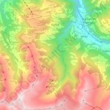
Name: Furna topographic map, elevation, terrain.
Location: Furna, Prättigau/Davos, Graubünden, 7232, Zwitserland (46.86443 9.62716 46.95813 9.69611)
Average elevation: 1,557 m
Minimum elevation: 671 m
Maximum elevation: 2,518 m