
Veckring topographic map
Interactive map
Click on the map to display elevation.
About this map
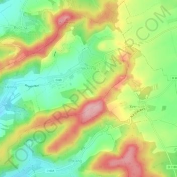
Name: Veckring topographic map, elevation, terrain.
Average elevation: 265 m
Minimum elevation: 193 m
Maximum elevation: 350 m
Other topographic maps
Click on a map to view its topography, its elevation and its terrain.
Ouvrage du Hackenberg
Frankrijk > Grand Est > Veckring
Ouvrage du Hackenberg, Route du Hackenberg, Veckring, Thionville, Moselle, Grand Est, Metropolitaans Frankrijk, 57920, Frankrijk
Average elevation: 258 m