
Cusseta topographic map
Interactive map
Click on the map to display elevation.
About this map
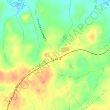
Name: Cusseta topographic map, elevation, terrain.
Location: Cusseta, Chambers County, Alabama, United States (32.77236 -85.32433 32.79943 -85.28789)
Average elevation: 212 m
Minimum elevation: 187 m
Maximum elevation: 236 m
Other topographic maps
Click on a map to view its topography, its elevation and its terrain.
Langdale
United States > Alabama > Chambers County > Valley
Langdale, Valley, Chambers County, Alabama, 36854, United States
Average elevation: 185 m