Geolocate

Rice topographic map

Click on the map to display elevation.

About this map

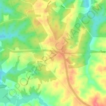
Name: Rice topographic map, elevation, terrain.

Location: Rice, Prince Edward County, Virginia, United States (37.25321 -78.31039 37.29321 -78.27039)

Average elevation: 128 m

Minimum elevation: 93 m

Maximum elevation: 165 m

Other topographic maps

Click on a map to view its topography, its elevation and its terrain.

Gear up for your next adventure:

🛌Insulated Sleeping Mats - Crucial thermal protection when sleeping on cold, uneven ground
🧴Tick Removal Tools - Small, essential health tool for UK woodland and moorland
🧥Waterproof Hiking Jackets - Rain protection for walking in all weather conditions
👖Convertible Hiking Trousers - Versatile zip-off pants for changing mountain weather conditions
🧭Orienteering Compasses - Accurate compasses for map-based navigation

As an Amazon Associate, this site earns from qualifying purchases at no extra cost to you.