
Make a donation
Gear up for your next adventure:
As an Amazon Associate, this site earns from qualifying purchases at no extra cost to you.
Bryson City topographic map
Click on the map to display elevation.
Make a donation
Gear up for your next adventure:
As an Amazon Associate, this site earns from qualifying purchases at no extra cost to you.
About this map
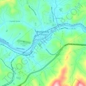
Name: Bryson City topographic map, elevation, terrain.
Location: Bryson City, Swain County, North Carolina, United States (35.41109 -83.46881 35.44043 -83.42117)
Average elevation: 592 m
Minimum elevation: 515 m
Maximum elevation: 817 m
Make a donation
Gear up for your next adventure:
As an Amazon Associate, this site earns from qualifying purchases at no extra cost to you.
Other topographic maps
Click on a map to view its topography, its elevation and its terrain.
Kuwohi
United States > North Carolina > Swain County
At an elevation of 6,643 feet (2,025 m), it is the highest mountain in the Great Smoky Mountains National Park, the highest point in the state of Tennessee, and the highest point along the 2,192-mile (3,528 km) Appalachian Trail. It is also the third highest point in eastern mainland North America, after Mount…
Average elevation: 1,716 m
Fontana Dam
United States > North Carolina > Swain County
Fontana Dam is 2,365 feet (721 m) long and 480 feet (146 m) high, making it the tallest dam in the Eastern United States. The dam has a flood storage capacity of 513,965 acre-feet (633,966,000 m3), and the combined capacity of its three generators is 293.6 megawatts. Fontana Lake has 238 miles (383 km) of…
Average elevation: 525 m
Make a donation
Gear up for your next adventure:
As an Amazon Associate, this site earns from qualifying purchases at no extra cost to you.
Ravensford
United States > North Carolina > Swain County > Yellowhill Community
Average elevation: 771 m
Make a donation
Gear up for your next adventure:
As an Amazon Associate, this site earns from qualifying purchases at no extra cost to you.
Kuwohi
United States > North Carolina > Swain County
At an elevation of 6,643 feet (2,025 m), it is the highest mountain in the Great Smoky Mountains National Park, the highest point in the state of Tennessee, and the highest point along the 2,192-mile (3,528 km) Appalachian Trail. It is also the third highest point in eastern mainland North America, after Mount…
Average elevation: 1,716 m
Make a donation
Gear up for your next adventure:
As an Amazon Associate, this site earns from qualifying purchases at no extra cost to you.
Make a donation
Gear up for your next adventure:
As an Amazon Associate, this site earns from qualifying purchases at no extra cost to you.
Cherokee
United States > North Carolina > Swain County > Yellowhill Community
Cherokee and its surrounding Qualla Boundary is in the very mountainous Swain and Jackson counties. The highest elevation is 6,643-foot (2,025 m) Clingman's Dome at the border with Tennessee. Clingman's Dome is the highest point in the Great Smoky Mountains National Park. The Oconaluftee River flows through…
Average elevation: 746 m