
Gemeinde Weiler topographic map
Interactive map
Click on the map to display elevation.
About this map
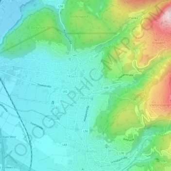
Name: Gemeinde Weiler topographic map, elevation, terrain.
Location: Gemeinde Weiler, Bezirk Feldkirch, Vorarlberg, 6837, Austria (47.29577 9.62051 47.31594 9.67261)
Average elevation: 636 m
Minimum elevation: 435 m
Maximum elevation: 1,135 m