
Fort Stevens Park topographic map
Click on the map to display elevation.
About this map
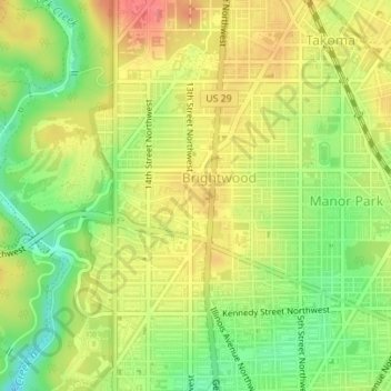
Name: Fort Stevens Park topographic map, elevation, terrain.
Average elevation: 77 m
Minimum elevation: 35 m
Maximum elevation: 116 m
Other topographic maps
Click on a map to view its topography, its elevation and its terrain.
Rock Creek Park and Piney Branch Parkway
United States > District of Columbia > Washington
Average elevation: 83 m
Buzzard Point
United States > District of Columbia > Washington
The United States Geological Survey's (USGS) most recent topographic maps identify the tip of the peninsula that contains Fort McNair as "Greenleaf Point". The USGS maps also identify a lesser point to the northeast of Greenleaf Point as "Buzzard Point". (James Creek, which was excavated during the 19th…
Average elevation: 6 m