
Les Salvis topographic map
Interactive map
Click on the map to display elevation.
About this map
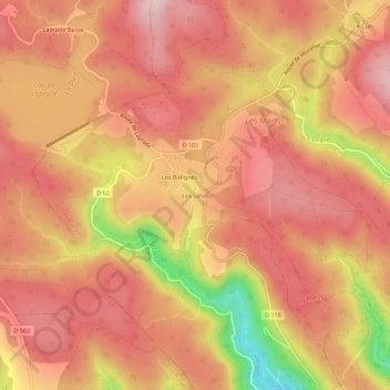
Name: Les Salvis topographic map, elevation, terrain.
Average elevation: 770 m
Minimum elevation: 567 m
Maximum elevation: 861 m
Other topographic maps
Click on a map to view its topography, its elevation and its terrain.
Les Batignès
France > Occitanie > Aude > Les Martys
Les Batignès, Les Martys, Carcassonne, Aude, Occitanie, France métropolitaine, 11390, France
Average elevation: 774 m