
Gablers topographic map
Interactive map
Click on the map to display elevation.
About this map
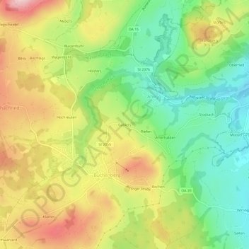
Name: Gablers topographic map, elevation, terrain.
Average elevation: 861 m
Minimum elevation: 740 m
Maximum elevation: 1,010 m
Other topographic maps
Click on a map to view its topography, its elevation and its terrain.
Rottach
Deutschland > Bayern > Landkreis Oberallgäu > Ahegg
Rottach, Ahegg, Buchenberg, Landkreis Oberallgäu, Bayern, 87439, Deutschland
Average elevation: 756 m