Geolocate

Kauri topographic map

Click on the map to display elevation.

About this map

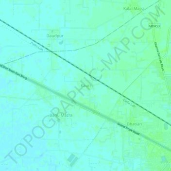
Name: Kauri topographic map, elevation, terrain.

Location: Kauri, Khanna Tahsil, Ludhiana, Punjab, 141417, India (30.70394 76.16958 30.74394 76.20958)

Average elevation: 265 m

Minimum elevation: 262 m

Maximum elevation: 269 m

Gear up for your next adventure:

📷Outdoor Action Cameras - Cameras designed for hiking and adventure
🎒Hiking Daypacks (20L) - Compact backpacks for day trips and technical mountain ascents
🌄Outdoor Binoculars - Compact binoculars for landscape observation
🌦️Portable Weather Meters - Handheld tools for monitoring weather conditions
🧊Insulated Flasks - Keeps drinks hot or cold during hikes

As an Amazon Associate, this site earns from qualifying purchases at no extra cost to you.