
Ellington Township topographic map
Interactive map
Click on the map to display elevation.
About this map
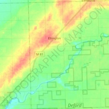
Name: Ellington Township topographic map, elevation, terrain.
Location: Ellington Township, Tuscola County, Michigan, United States (43.49607 -83.35088 43.58511 -83.22912)
Average elevation: 221 m
Minimum elevation: 199 m
Maximum elevation: 252 m
Other topographic maps
Click on a map to view its topography, its elevation and its terrain.
Gilford Township
United States > Michigan > Tuscola County > Gilford Township
Gilford Township, Tuscola County, Michigan, 48733, United States
Average elevation: 187 m