
Calafell topographic map
Interactive map
Click on the map to display elevation.
About this map
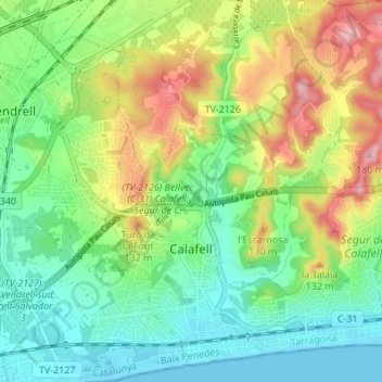
Name: Calafell topographic map, elevation, terrain.
Location: Calafell, Bas-Pénédais, Tarragone, Catalogne, 43882, Espagne (41.18364 1.55732 41.23482 1.62141)
Average elevation: 63 m
Minimum elevation: 0 m
Maximum elevation: 177 m
Other topographic maps
Click on a map to view its topography, its elevation and its terrain.
Bonastre
Espagne > Catalogne > Bas-Pénédais
Bonastre, Bas-Pénédais, Tarragone, Catalogne, 43884, Espagne
Average elevation: 234 m