
Thank you for supporting this site ❤️
Make a donation
Make a donation
Gear up for your next adventure:
As an Amazon Associate, this site earns from qualifying purchases at no extra cost to you.
Bagdara WLS topographic map
Click on the map to display elevation.
Thank you for supporting this site ❤️
Make a donation
Make a donation
Gear up for your next adventure:
As an Amazon Associate, this site earns from qualifying purchases at no extra cost to you.
About this map
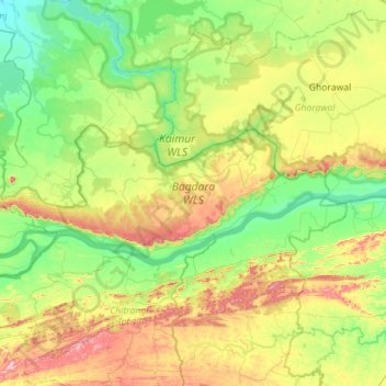
Name: Bagdara WLS topographic map, elevation, terrain.
Location: Bagdara WLS, Lalganj, Mirzapur District, Uttar Pradesh, India (24.52160 82.38032 24.70269 82.94519)
Average elevation: 279 m
Minimum elevation: 150 m
Maximum elevation: 567 m
Thank you for supporting this site ❤️
Make a donation
Make a donation
Gear up for your next adventure:
As an Amazon Associate, this site earns from qualifying purchases at no extra cost to you.