
Parodi Ligure topographic map
Interactive map
Click on the map to display elevation.
About this map
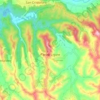
Name: Parodi Ligure topographic map, elevation, terrain.
Location: Parodi Ligure, Alessandria, Piemont, Italien (44.65248 8.73097 44.69094 8.79170)
Average elevation: 272 m
Minimum elevation: 179 m
Maximum elevation: 396 m
Der Ort liegt auf einer Höhe von 330 m über dem Meeresspiegel. Das Gemeindegebiet umfasst eine Fläche von 12,5 km².