
Thank you for supporting this site ❤️
Make a donation
Make a donation
Gear up for your next adventure:
As an Amazon Associate, this site earns from qualifying purchases at no extra cost to you.
Wajak topographic map
Click on the map to display elevation.
Thank you for supporting this site ❤️
Make a donation
Make a donation
Gear up for your next adventure:
As an Amazon Associate, this site earns from qualifying purchases at no extra cost to you.
About this map
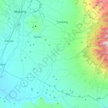
Name: Wajak topographic map, elevation, terrain.
Location: Wajak, Kabupaten Malang, East Java, Java, 65173, Indonesia (-8.26316 112.57534 -7.94316 112.89534)
Average elevation: 660 m
Minimum elevation: 293 m
Maximum elevation: 2,824 m
Thank you for supporting this site ❤️
Make a donation
Make a donation
Gear up for your next adventure:
As an Amazon Associate, this site earns from qualifying purchases at no extra cost to you.