
Thank you for supporting this site ❤️
Make a donation
Make a donation
Gear up for your next adventure:
As an Amazon Associate, this site earns from qualifying purchases at no extra cost to you.
Ramil topographic map
Click on the map to display elevation.
Thank you for supporting this site ❤️
Make a donation
Make a donation
Gear up for your next adventure:
As an Amazon Associate, this site earns from qualifying purchases at no extra cost to you.
About this map
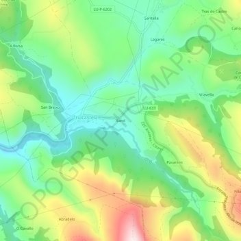
Name: Ramil topographic map, elevation, terrain.
Location: Ramil, Triacastela, Sarria, Lugo, Galice, 27632, Espagne (42.73580 -7.25178 42.77580 -7.21178)
Average elevation: 801 m
Minimum elevation: 627 m
Maximum elevation: 1,109 m
Thank you for supporting this site ❤️
Make a donation
Make a donation
Gear up for your next adventure:
As an Amazon Associate, this site earns from qualifying purchases at no extra cost to you.