Geolocate

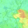
Lahn topographic map

Click on the map to display elevation.

About this map

Name: Lahn topographic map, elevation, terrain.

Location: Lahn, Samtgemeinde Werlte, Landkreis Emsland, Lower Saxony, Germany (52.78517 7.56521 52.83890 7.65397)

Average elevation: 33 m

Minimum elevation: 22 m

Maximum elevation: 43 m

Other topographic maps

Click on a map to view its topography, its elevation and its terrain.

Elbergen

Germany > Lower Saxony > Landkreis Emsland

Average elevation: 28 m

Mühlenmoor

Germany > Lower Saxony > Landkreis Emsland > Meppen > Helte

Average elevation: 17 m

Emen

Germany > Lower Saxony > Landkreis Emsland > Haren (Ems)

Average elevation: 13 m

Gear up for your next adventure:

📷Camera Straps - Secure straps for carrying cameras while walking
🧥Softshell Jackets - Breathable jackets for active outdoor use
🧭Professional Hiking Compasses - High-precision liquid-filled compasses for map reading and orientation
🧼Camping Hygiene Kits - Compact hygiene essentials for outdoor stays
🥤Hiking Water Bottles - Reusable bottles for hydration on the trail

As an Amazon Associate, this site earns from qualifying purchases at no extra cost to you.