
el Bruc topographic map
Interactive map
Click on the map to display elevation.
About this map
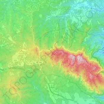
Name: el Bruc topographic map, elevation, terrain.
Location: el Bruc, Anoia, Barcelona, Catalonië, 08294, Spanje (41.56488 1.70488 41.65490 1.81286)
Average elevation: 529 m
Minimum elevation: 173 m
Maximum elevation: 1,224 m
Other topographic maps
Click on a map to view its topography, its elevation and its terrain.
Parc Natural de la Muntanya de Montserrat
Spanje > Catalonië > Anoia > el Bruc
Parc Natural de la Muntanya de Montserrat, el Bruc, Anoia, Barcelona, Catalonië, 08199, Spanje
Average elevation: 516 m