
Kjustendil topographic map
Interactive map
Click on the map to display elevation.
About this map
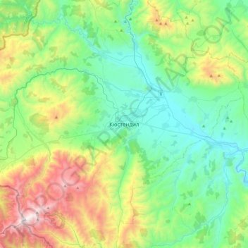
Name: Kjustendil topographic map, elevation, terrain.
Location: Kjustendil, Oblast Kjustendil, 2500, Bulgarien (42.12100 22.52902 42.44100 22.84902)
Average elevation: 929 m
Minimum elevation: 424 m
Maximum elevation: 2,250 m