Geolocate

04158 topographic map

Click on the map to display elevation.

About this map

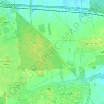
Name: 04158 topographic map, elevation, terrain.

Location: 04158, Lindenthal, Nordwest, Leipzig, Saxony, Germany (51.40276 12.32811 51.40286 12.32821)

Average elevation: 131 m

Minimum elevation: 122 m

Maximum elevation: 138 m

Other topographic maps

Click on a map to view its topography, its elevation and its terrain.

Leipzig

Germany > Saxony > Leipzig

Average elevation: 127 m

Tensa

Germany > Saxony > Leipzig

Average elevation: 134 m

Tensa

Germany > Saxony > Leipzig

Average elevation: 134 m

Gear up for your next adventure:

🔋Solar Chargers - Eco-friendly charging solutions for outdoor use
Lightweight Solo Tents - Backpacking tents designed for wild camping in the UK highlands
👕Merino Base Layers - Natural temperature regulation for cold weather hiking and camping
🔋Lithium AA Batteries - Long-lasting power that performs well in cold mountain weather
🥾Women's Waterproof Hiking Boots - High-performance trekking boots designed for all-weather comfort

As an Amazon Associate, this site earns from qualifying purchases at no extra cost to you.