
Thank you for supporting this site ❤️
Make a donation
Make a donation
Gear up for your next adventure:
As an Amazon Associate, this site earns from qualifying purchases at no extra cost to you.
Cherambadi topographic map
Click on the map to display elevation.
Thank you for supporting this site ❤️
Make a donation
Make a donation
Gear up for your next adventure:
As an Amazon Associate, this site earns from qualifying purchases at no extra cost to you.
About this map
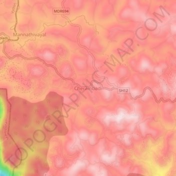
Name: Cherambadi topographic map, elevation, terrain.
Location: Cherambadi, Pandalur, Nilgiris, Tamil Nadu, 643205, India (11.49666 76.24710 11.53666 76.28710)
Average elevation: 855 m
Minimum elevation: 544 m
Maximum elevation: 942 m
Thank you for supporting this site ❤️
Make a donation
Make a donation
Gear up for your next adventure:
As an Amazon Associate, this site earns from qualifying purchases at no extra cost to you.