Geolocate

Lucap topographic map

Click on the map to display elevation.

About this map

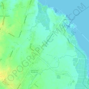
Name: Lucap topographic map, elevation, terrain.

Location: Lucap, Alaminos, Pangasinan, Ilocos Region, Philippines (16.17179 119.98937 16.19622 120.00723)

Average elevation: 9 m

Minimum elevation: 0 m

Maximum elevation: 24 m

Other topographic maps

Click on a map to view its topography, its elevation and its terrain.

Alaminos

Philippines > Pangasinan > Alaminos

Average elevation: 44 m

Gear up for your next adventure:

🎿Telescopic Trekking Poles - Reduces knee strain on steep topographic descents
🛑Emergency Bivvy Bags - Heat-reflective survival bags for unexpected nights out
👟Men's Trail Running Shoes - Lightweight grip for fast movement over topographic contours
🐕Hiking Dog Harnesses - Rugged harnesses for taking your companion on mountain trails
GPS Outdoor Watches - Watches with GPS tracking for hiking and exploration

As an Amazon Associate, this site earns from qualifying purchases at no extra cost to you.