
Troy topographic map
Interactive map
Click on the map to display elevation.
About this map
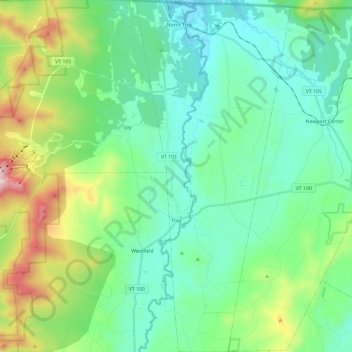
Name: Troy topographic map, elevation, terrain.
Location: Troy, Orleans County, Vermont, 05868, United States (44.84131 -72.43331 45.00793 -72.32924)
Average elevation: 378 m
Minimum elevation: 155 m
Maximum elevation: 1,087 m
Other topographic maps
Click on a map to view its topography, its elevation and its terrain.