
Pendergrass topographic map
Interactive map
Click on the map to display elevation.
About this map
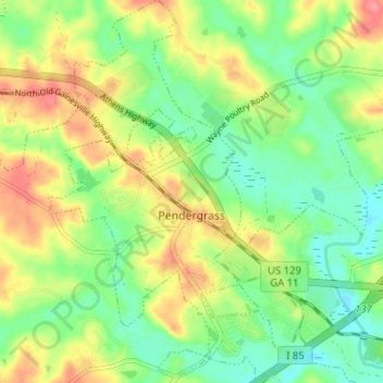
Name: Pendergrass topographic map, elevation, terrain.
Location: Pendergrass, Jackson County, Georgia, 30567, United States (34.13932 -83.70171 34.19192 -83.66172)
Average elevation: 243 m
Minimum elevation: 212 m
Maximum elevation: 285 m