
Thank you for supporting this site ❤️
Make a donation
Make a donation
Gear up for your next adventure:
As an Amazon Associate, this site earns from qualifying purchases at no extra cost to you.
Fihaonana topographic map
Click on the map to display elevation.
Thank you for supporting this site ❤️
Make a donation
Make a donation
Gear up for your next adventure:
As an Amazon Associate, this site earns from qualifying purchases at no extra cost to you.
About this map
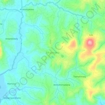
Name: Fihaonana topographic map, elevation, terrain.
Location: Fihaonana, Analamanga, Province d’Antananarivo, Madagascar (-18.62407 47.18699 -18.58407 47.22699)
Average elevation: 1,318 m
Minimum elevation: 1,272 m
Maximum elevation: 1,440 m
Thank you for supporting this site ❤️
Make a donation
Make a donation
Gear up for your next adventure:
As an Amazon Associate, this site earns from qualifying purchases at no extra cost to you.