
Hering topographic map
Interactive map
Click on the map to display elevation.
About this map
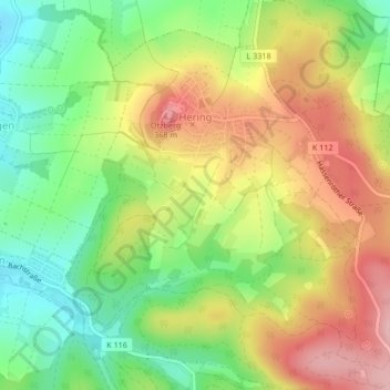
Name: Hering topographic map, elevation, terrain.
Location: Hering, Otzberg, Landkreis Darmstadt-Dieburg, Hesse, Germany (49.80279 8.90433 49.82583 8.93396)
Average elevation: 270 m
Minimum elevation: 187 m
Maximum elevation: 364 m
Other topographic maps
Click on a map to view its topography, its elevation and its terrain.
Seeheim-Jugenheim
Germany > Hesse > Landkreis Darmstadt-Dieburg > Seeheim-Jugenheim > Seeheim-Jugenheim
Average elevation: 213 m