
A Conchada topographic map
Interactive map
Click on the map to display elevation.
About this map
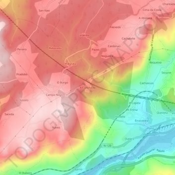
Name: A Conchada topographic map, elevation, terrain.
Location: A Conchada, Palmés, Ourense, Galiza, 32172, Espanha (42.34244 -7.95183 42.38244 -7.91183)
Average elevation: 312 m
Minimum elevation: 87 m
Maximum elevation: 453 m
Other topographic maps
Click on a map to view its topography, its elevation and its terrain.