
Cambium topographic map
Interactive map
Click on the map to display elevation.
About this map
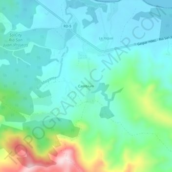
Name: Cambium topographic map, elevation, terrain.
Location: Cambium, Gaspar Hernández, Espaillat, Dominican Republic (19.58196 -70.19565 19.62196 -70.15565)
Average elevation: 86 m
Minimum elevation: 0 m
Maximum elevation: 377 m
Other topographic maps
Click on a map to view its topography, its elevation and its terrain.