
Daïra de Teniet El Abed topographic map
Interactive map
Click on the map to display elevation.
About this map
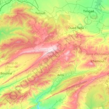
Name: Daïra de Teniet El Abed topographic map, elevation, terrain.
Location: Daïra de Teniet El Abed, Batna, RADP (35.17148 6.04920 35.49547 6.54076)
Average elevation: 1,433 m
Minimum elevation: 819 m
Maximum elevation: 2,296 m
Other topographic maps
Click on a map to view its topography, its elevation and its terrain.