
Walker topographic map
Interactive map
Click on the map to display elevation.
About this map
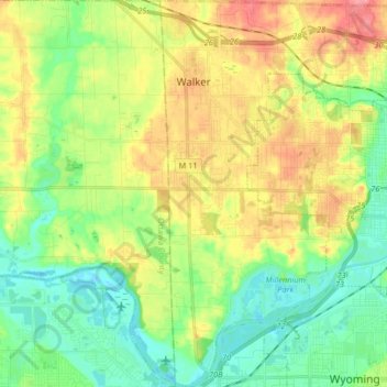
Name: Walker topographic map, elevation, terrain.
Location: Walker, Kent County, Míchigan, Estados Unidos de América (42.91067 -85.78858 43.03089 -85.66062)
Average elevation: 209 m
Minimum elevation: 177 m
Maximum elevation: 258 m