
Thank you for supporting this site ❤️
Make a donation
Make a donation
Gear up for your next adventure:
As an Amazon Associate, this site earns from qualifying purchases at no extra cost to you.
Kichwa topographic map
Click on the map to display elevation.
Thank you for supporting this site ❤️
Make a donation
Make a donation
Gear up for your next adventure:
As an Amazon Associate, this site earns from qualifying purchases at no extra cost to you.
About this map
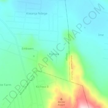
Name: Kichwa topographic map, elevation, terrain.
Location: Kichwa, Soin ward, Rongai, Nakuru, Kenya (-0.13936 35.99481 -0.09936 36.03481)
Average elevation: 1,773 m
Minimum elevation: 1,704 m
Maximum elevation: 1,991 m
Thank you for supporting this site ❤️
Make a donation
Make a donation
Gear up for your next adventure:
As an Amazon Associate, this site earns from qualifying purchases at no extra cost to you.