
Damvant topographic map
Interactive map
Click on the map to display elevation.
About this map
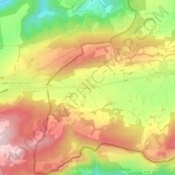
Name: Damvant topographic map, elevation, terrain.
Location: Damvant, Haute-Ajoie, District de Porrentruy, Jura, 2914, Suisse (47.35215 6.87726 47.39215 6.91726)
Average elevation: 624 m
Minimum elevation: 418 m
Maximum elevation: 788 m
Other topographic maps
Click on a map to view its topography, its elevation and its terrain.
Chevenez
Suisse > Jura > District de Porrentruy > Haute-Ajoie
Chevenez, Haute-Ajoie, District de Porrentruy, Jura, 2906, Suisse
Average elevation: 572 m