Geolocate

Redham topographic map

Click on the map to display elevation.

About this map

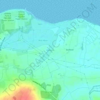
Name: Redham topographic map, elevation, terrain.

Location: Redham, Stolford, Stogursey, Somerset, England, United Kingdom (51.19589 -3.12067 51.20372 -3.11186)

Average elevation: 11 m

Minimum elevation: 0 m

Maximum elevation: 59 m

Somerset trails, hiking, mountain biking, running and outdoor activities

Gear up for your next adventure:

📷Camera Straps - Secure straps for carrying cameras while walking
🔦Keychain LED Torches - Emergency backup light for finding gear in your pack
🧺Ultralight Dry Bags - Organize and waterproof your gear inside your rucksack
🥾Hiking Boot Waterproofing Wax - Maintain the lifespan of your leather trekking boots
👕Merino Base Layers - Natural temperature regulation for cold weather hiking and camping

As an Amazon Associate, this site earns from qualifying purchases at no extra cost to you.