
Castel di Sangro topographic map
Interactive map
Click on the map to display elevation.
About this map
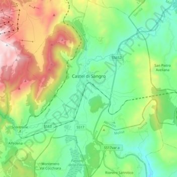
Name: Castel di Sangro topographic map, elevation, terrain.
Location: Castel di Sangro, L'Aquila, Abruzzo, 67031, Italy (41.70833 14.04605 41.84093 14.20197)
Average elevation: 1,075 m
Minimum elevation: 622 m
Maximum elevation: 2,076 m
Other topographic maps
Click on a map to view its topography, its elevation and its terrain.